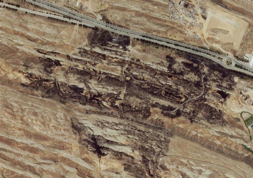
Exclusive: Satellite images show the extent of Parchin explosion in Tehran
Iran International has acquired satellite images that show the early Friday explosion in Parchin and Khojir military zone in Tehran has impacted an area of half a kilometer. The satellite images show burning signs in a vast area of hills next to Parchin military-industrial facilities.
According to the satellite images, the ammunitions facility and the cruise missile factory building were both in the area of the explosion in Parchin.
Several Khojir military base personnel and eyewitnesses have called Iran International and confirmed the data.
One eyewitness told Iran International: The explosion was very loud and happened near the ammunition facilities. The sound of fire trucks continued until morning and all forces were on high alert.”
An explosion occurred in the early hours of Friday and lit the night sky in an orange color for several seconds.
The spokesman for the Islamic Republic’s Defense Ministry has claimed that the explosion was due to “gas leak” in the Parchin area and there have been no casualties.
Many experts believe the claim by the ministry as an attempt to present the explosion as an insignificant incident, even though several nuclear facilities and cruise missile stockpiles are located in Parchin military-industrial zone.
Israeli media have speculated the possibility of sabotage or a cyber-attack against these facilities.
Iran International contacted the office of Israel’s prime minister about the reports of the explosion in Parchin, but the office refused to comment.

